Oltschiburg
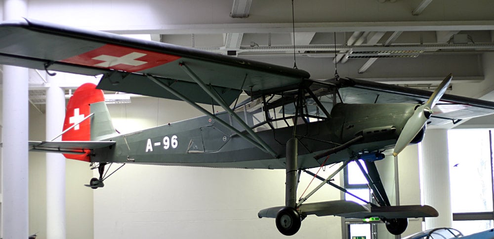
Secret flight exercise behind the Oltschiburg with the Fieseler Storch
On November 19, 1946, an American Douglas C-53 (Dakota) crashed in rugged terrain at 3350 m above sea level on the Gauli Glacier. All occupants survived the crash landing in the eternal ice. After a rescue with conventional means was impossible and an evacuation of the poorly equipped and exhausted victims on foot was out of the question, there was only one possible method of rescue. Pilots of the Swiss Air Force had recently conducted training flights with the aircraft type known as the Fieseler Storch, Fieseler FI-156. The aim of these training flights was to drop light troops in rugged alpine terrain during the winter. For these pioneering efforts, the gently sloping terrain behind the Oltschiburg was chosen as the testing ground.
Plane Crash on the Gauli Glacier
The Gauli Glacier, located on Meiringen soil, was the scene of an emergency landing by an American Douglas C-53 on November 19, 1946. All crew members and passengers survived the crash, although some suffered injuries caused by the “beaching” of the aircraft.
The plane survived the crash without significant damage. However, it was not possible to think of another takeoff from the glacier. After the pilots could send out a distress call, which was received at Paris-Orly airport, the US military launched a search operation unprecedented in its scale, involving 80 aircraft. Since the pilots, due to the bad weather conditions, had “lost their bearings”, they believed themselves to be in the French Alps rather than the Swiss.
It was thanks to the attentive flight controller in Meiringen, who noticed that the radio signals were unusually clear, that he considered the possibility of a second bearing of the radio signal, including the Swiss Alps as a possible crash site. After the accidental discovery of the crashed machine between Rosenhorn and Wetterhorn at over 3,500 meters above sea level, the extensive search operation was undertaken by American alpine soldiers and Swiss mountain rescue teams.

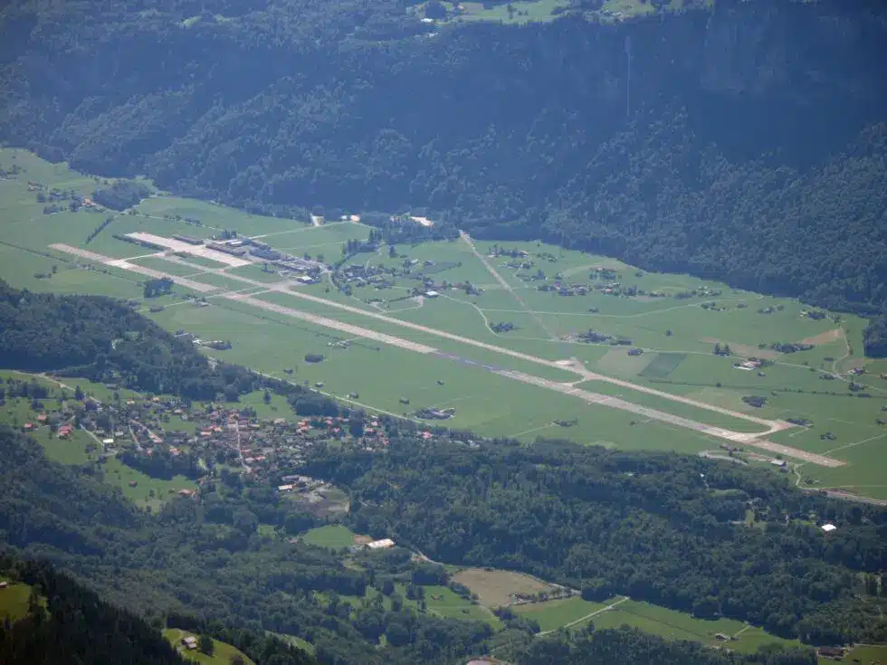
Meiringen (Unterbach) Air Base
The Meiringen military air base is one of the four Swiss military airfields. As an important economic factor with around 200 jobs, opinions about the airfield are divided. For aviation enthusiasts, it is a fascinating place. The regular takeoffs and landings of the stationed F/A-18 Hornets can be easily observed from Brienzwiler. While the airfield serves to ensure the operational readiness of the Swiss Air Force, regular flight exercises mainly take place during the tourist off-season.
Melchior Anderegg
Melchior Anderegg was, together with Christian Almer, the first mountain guide to obtain the Swiss mountain guide patent in 1856. Not least due to his outstanding alpine abilities, he earned the title of ‘King of the Guides.’ Melchior Anderegg grew up on the opposite side of the valley from Brienzwiler, in ‘Zaun’ near Meiringen. His birthplace is still a picturesque piece of land that can be wonderfully explored on a day hike from Brienzwiler. Melchior Anderegg was the first to summit numerous renowned peaks in the Western Alps. One of his most prominent guests was the founder of the English ‘Alpine Club,’ Leslie Stephen.

Locations of the Virtual Tour
Nature garden
Nature gardenGoethe on the Wyler BridgeIt is October 13, 1779 – three well-dressed gentlemen step onto the Wyler Bridge down in the valley. One of them would later dictate to his secretary at the Hotel Kreuz in Brienz how they marveled at the “terrifying mountain...
Fresco Schoolhouse
Fresco SchoolhouseFresco Schoolhouse/Allmendnussen"God gave us the nuts; let us crack them together!"This saying accompanies the sgraffito at the Brienzwiler schoolhouse. It was created by Heinz Schild and his team to commemorate the construction of the new gymnasium....
Church
ChurchChurchThe small, cozy wooden church with 160 seats was built with contributions from the canton and the Synod Council, as well as countless volunteer hours from the local community, and was consecrated in 1940.The building materials primarily come from the...
Village square
Village squareHistory of the Coat of Arms“Wyler am Brünig”, as Brienzwiler was once called, has always been located on the important transit axis of the Brünig Pass. The old path led from Kienholz (Brienz) via Hofstetten to the “Schloss” district of Brienzwiler and...
Änderdorf
AenderdorfStart of the Zwergliloch TrailThe circular trail to Zwergliloch is a varied hike around Brienzwiler. Duration is approximately 1 hour. NOT SUITABLE FOR PEOPLE WITH MOBILITY IMPAIRMENTS AND SMALL CHILDRENBy Stagecoach over the BrünigThe Brünig Pass road has...

